Recent pre-made simulator maps/courses
Example run, H21 SM keskimatka 2026
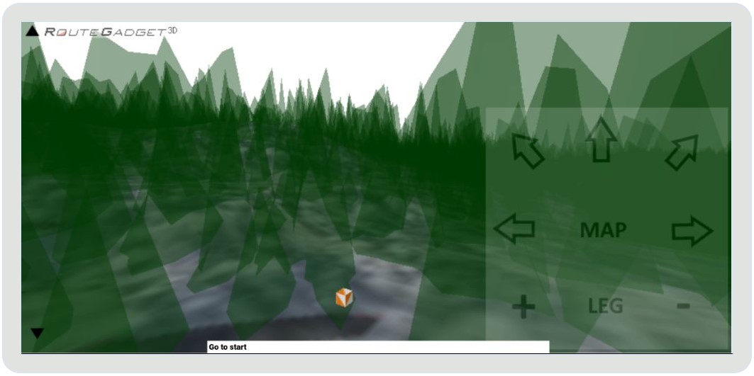
Instructions
Open map, select a course (some of them have more than one), then from bottom left start simulator.
You can also use your own maps and courses. Just open them in 2d.routegadget.net, export map area in question (about 2 x 2km) as jpg with print/export button (you'll long name with coordinates in file name). Also click course with the course drawing tool and export it as a gpx file using the export button below the course tool. Then zip exported map and course gpx together and open the zip in 3d. You should then be able to run/play it in 3D.
Simulator is somewhat playable also with mobile device, at least android phone. Slide you finger(thumb) on top of the controller area at right hand side.
SM-viesti Ikaalinen ennakko (mapant-kartta)
Open
Ponsa SM pitkä 2025 ennakkoradat
Karsinta
Finaali
Lynx 2025 kansallisten eli SM2026 esikisan arvailuja (MapAnt kartta + ennakkopalat).
Nuorten Jukola 2025 (rata-arvailuja, vanha kartta)
Open
Ungi 2025 Skövde (old map)
Open
Loch Leven Lakes (Karttapullautin map)
Open
Brikland (MapAnt no):
Open
Grima (MapAnt es):
Open
Open
Ponsa SM pitkä 2025 ennakkoradat
Karsinta
Finaali
Lynx 2025 kansallisten eli SM2026 esikisan arvailuja (MapAnt kartta + ennakkopalat).
Nuorten Jukola 2025 (rata-arvailuja, vanha kartta)
Open
Ungi 2025 Skövde (old map)
Open
Loch Leven Lakes (Karttapullautin map)
Open
Brikland (MapAnt no):
Open
Grima (MapAnt es):
Open
Jukola 2025 preparation
North part (near competition center):
Open
South part:
Open
Idre world cup 2025 middle preparation
Open
WOC 2025 preparation
WOC 2025 Middle selection race quess:
Open
WOC 2025 Long selection race quess:
Open
WOC 2025 Qualification race quess:
Open